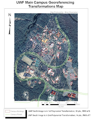
The Week 6 lab was much less frustrating for me than the previous one with much less trouble. The only thing which I had difficulty with was clipping a raster. I tried the ArcToolbox/Data Management Tool/Raster/Clip function with no luck. I originally added about 25 control points to the UWF South aerial and tried the 3rd Polynomial Transformation but thought it looked less accurate than with lesser control points and the 2nd Polynomial Transformation. My RMS was also much higher with more points for some reason so I left it in 2nd.
Hey Brian,
ReplyDeleteI'm going to have to deduct 1/2 point per day for turning this in late. I'll also send over an email about clipping rasters. It should help in the future.
Leah